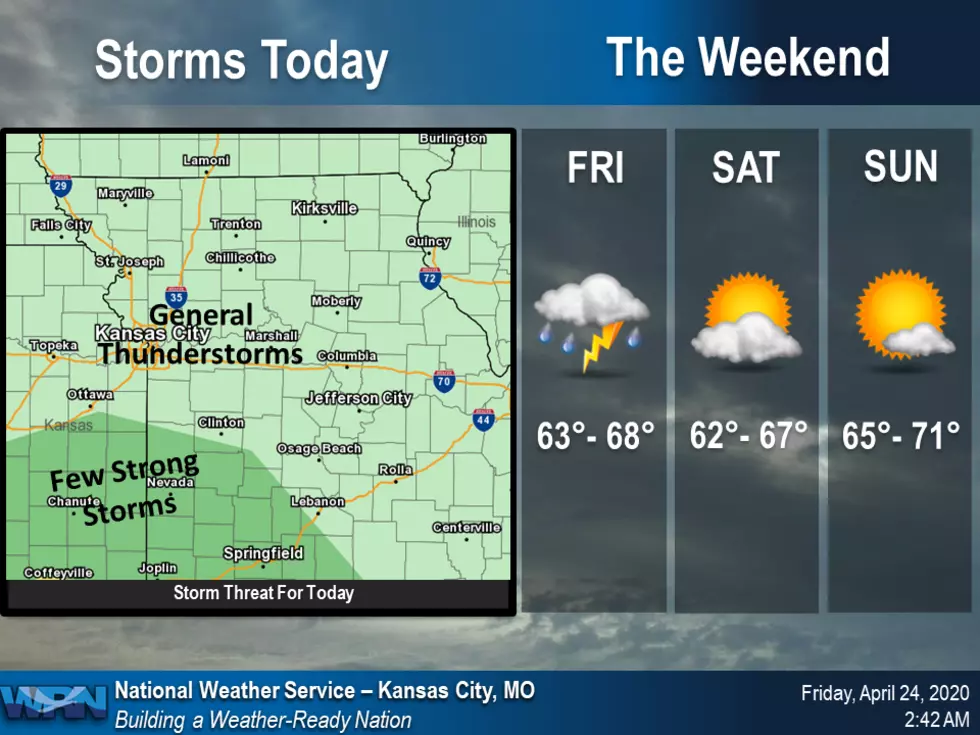
Rain and thunderstorms will continue to move out of the area this morning with cloudy skies and cooler temperatures through this afternoon. Storms are expected to return later tonight as they move up from southeast Kansas and southwest Missouri.
Strong to severe storms in the forecast as we get closer to the weekend. Hail and damaging winds will be the primary threat, but a tornado or two are also possible.
Strong to severe storms are possible throughout the day, but the best chance is tonight. Hail will be the primary threat, but damaging winds are also a possibility.
Light rain ending this morning. An active pattern will commence on Wednesday, with periods of heavy rain and perhaps some scattered strong to severe thunderstorms Wednesday evening.
A nice early spring-like day today with a cool start in the 40s and 60s by the afternoon. . Widespread rain will return to the area Thursday afternoon into Friday morning, but will clear out for a nice afternoon on Friday and into the weekend.
A few rounds of showers and thunderstorms will be possible today. The round of thunderstorms this afternoon will have the potential to produce a few strong storms capable of gusty winds and small hail across portions of east central Kansas and west central Missouri. Highs today will be in the mid 60's.