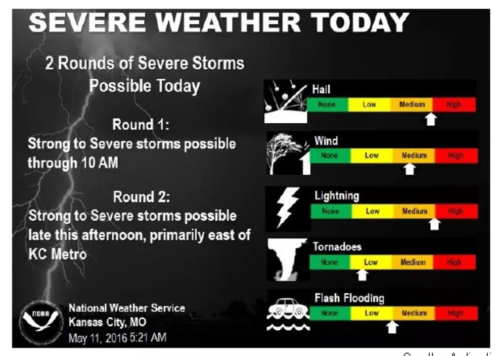
Chance of Severe Weather Back in the Forecast
According to Dave Clippert, Director of the Pettis County Emergency Management Agency, as these early morning storms pass to our west, we should remain clear of any other storms until mid to late afternoon. We are in a Slight Risk for today with a 2% chance of an isolated tornado, 15% chance of high winds 58 MPH or higher and a 15% chance of large hail, 1 inch or larger.
Timing on this could be as early as 4 PM and as late as midnight. If you have outdoor plans this evening, please keep an eye on the sky and be Storm Aware!
NWS-Kansas City

More From AM 1050 KSIS