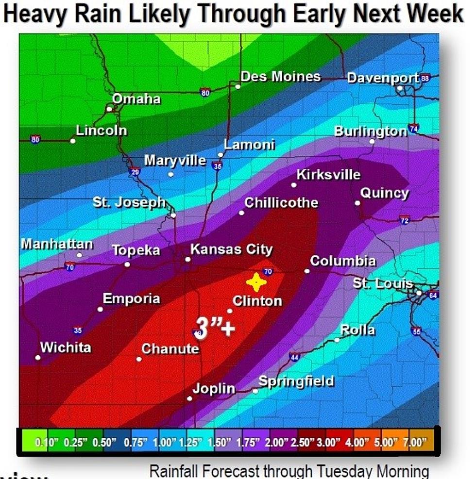
Flash Flood Watch Issued
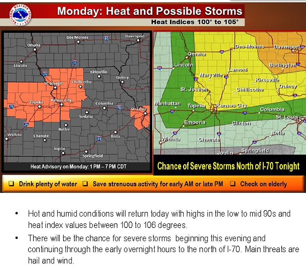
Our hot and muggy conditions may turn to rain through the day and into Monday (July 20), according to the National Weather Service.
THUNDERSTORM ACTIVITY CONTINUES TO EXPAND OVER EASTERN KANSAS
AND WESTERN MISSOURI THIS MORNING WITH TORRENTIAL RAIN FALLING.
ANOTHER ROUND OF WIDESPREAD HEAVY RAINFALL IS EXPECTED TO DEVELOP
TONIGHT OVER ROUGHLY THE SAME AREAS. WIDESPREAD RAINFALL AMOUNTS
OF 1 TO 3 INCHES IS LIKELY BUT THERE WILL ALSO BE LOCALIZED MUCH
HEAVIER AMOUNTS. WITH HOW SATURATED MUCH OF THE AREA IS FROM THE
CONTINUED WET WEATHER PATTERN... FLASH FLOODING IS LIKELY FROM
EAST CENTRAL KANSAS THROUGH NORTHERN AND CENTRAL MISSOURI.
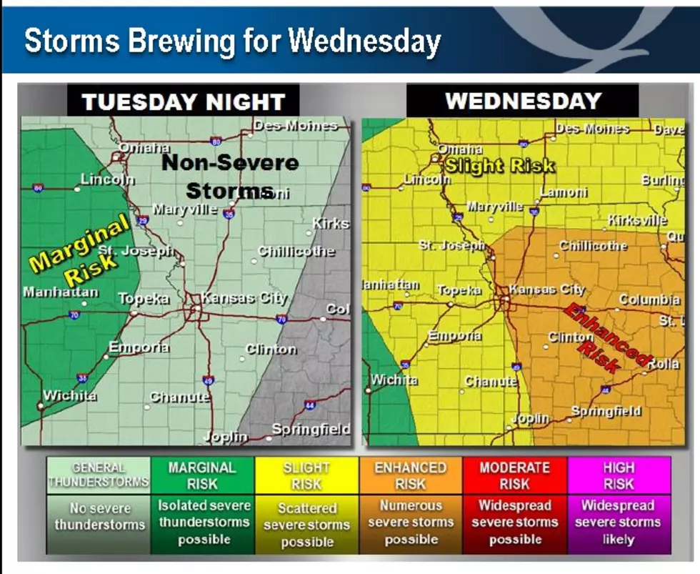
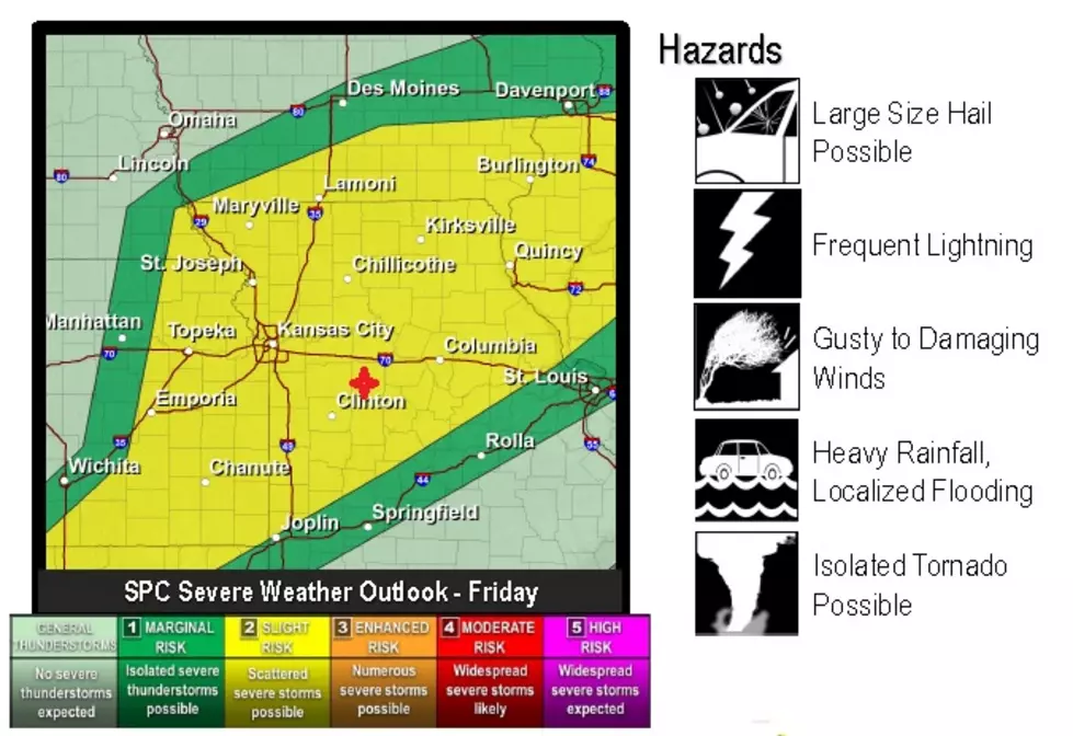
"Pettis County is in a Slight Risk for severe weather," said Sedalia/Pettis County Emergency Management Director David Clippert. "We have a 15% chance of a tornado, high winds or hail. Right now it looks as if it is a mostly wind but it could also bring very heavy downpours of rain, so flooding will again be a risk."
We'll keep track of our weather with Weathereye through the day.
More From AM 1050 KSIS