Strong Storms And Heavy Rain Back In Forecast
Wouldn't you think the weather would settle down now that we're in Fall? Not the case as potential heavy rain/storms are in the forecast for late this afternoon and tonight.
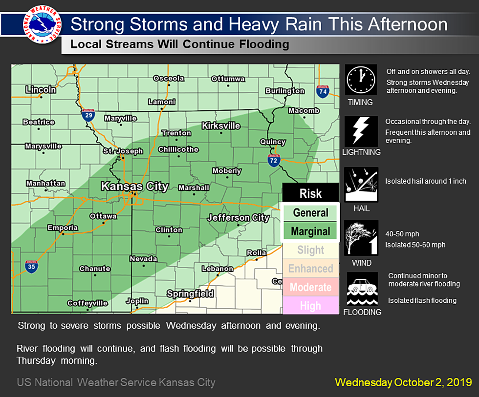
More rain is on the way for Wednesday. Off and on showers will be possible through the day, but as the afternoon and evening approach widespread moderate to heavy rain will be possible. Some of these storms could be strong to severe with hail up to 1 inch and 40-50 mph winds being the primary concerns. River flooding will continue and isolated flash flooding will also be possible through Thursday morning. After this rain moves out Thursday, the next chance for rain comes Saturday into Sunday morning.
According to the National weather Service:
DAY ONE...Today and Tonight

Strong to potentially severe thunderstorms will be possible along
the I-35 and I-70 corridors this afternoon and this evening. Gusty
winds up to 60 mph will be the primary concerns along with hail up to
1 inch.

Moderate to heavy rain will be likely within the same areal extent
today, and this will result in swollen creeks and streams to continue
their flooding. There will also be a chance for some flash flooding,
given local soils are sensitive to further rainfall.


DAYS TWO THROUGH SEVEN...Thursday through Tuesday

Another round of showers and thunderstorms will be possible Saturday
into Sunday morning. Widespread severe weather is not anticipated at
this time, but more rainfall will likely result in more flooding
along swollen creeks and streams.

More From AM 1050 KSIS