Heavy Rain Likely For Next Couple Of Days
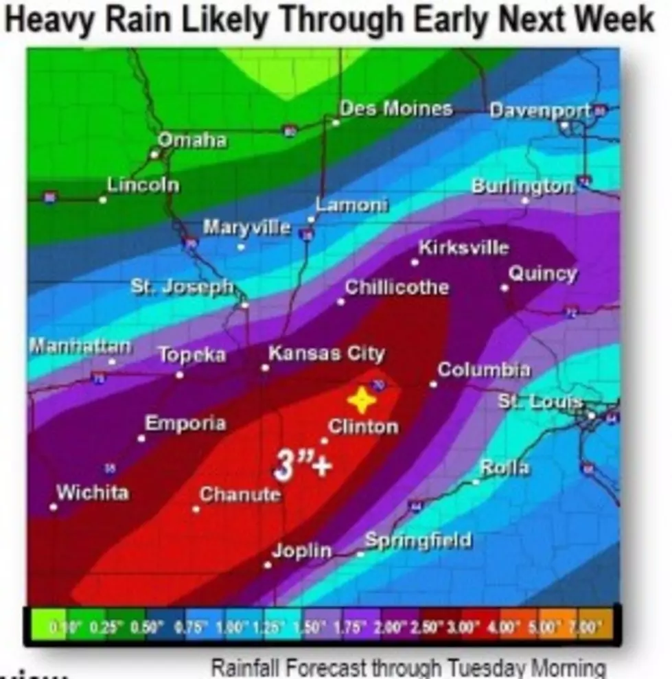
Rain is predicted each day through Friday, June 20 across West Central Missouri. This weekend there is plenty of outdoor activities planned and hopefully severe weather will not be too much of an issue for the International Harvesters, Wings Over Whiteman, Knob Noster Fair, Sedalia Bombers or any other outdoor activity planned.
"Although we are right on the edge of a Marginal Risk," said Sedalia/Pettis County EMA Director David Clippert. "This means isolated severe storms are possible, or a 2% chance. Our primary concern though is more rain. The ground is already saturated and even a short down pour could cause some flooding issues on the roads. Use caution while driving, and if you can't see the road under the water don't go through. Remember Turn Around Don't Drown!"
The National Weather Service in Pleasant Hill issued this statement about the forecast for the next week.
MULTIPLE ROUNDS OF THUNDERSTORMS THROUGH EARLY NEXT WEEK WILL RESULT IN
WIDESPREAD HEAVY RAINFALL WITH FLASH FLOODING POSSIBLE. THE HEAVY
RAINFALL WILL ALSO EXACERBATE THE ONGOING RIVER FLOODING. THE THREAT
OF SEVERE THUNDERSTORMS IS LOW.
We'll continue to keep track of your weather with Weathereye through the day.
More From AM 1050 KSIS