Mild and breezy conditions will prevail today with highs in the mid 60s to lower 70s. The rest of the week into the weekend looks unsettled with several chances for showers and thunderstorms.
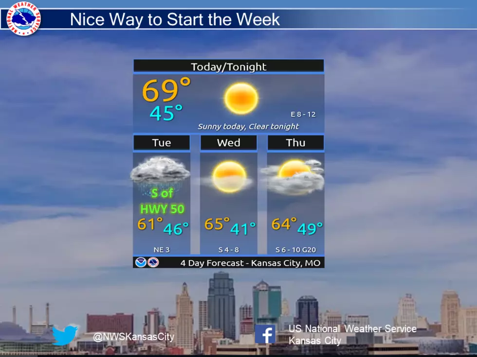
A nice way to start the week with sunny skies and 60-70s across the area. Light rain will move through the region tonight, mainly impacting areas south of HWY 50 Tuesday morning before clearing out quickly.
As we get through the first week of spring, we've had a typical taste of different weather patterns for this time of year. More early spring weather is in the forecast for the next seven days.
A cold front will move through the region and stall in our area. As warm air and moisture overrun that stalled front, strong to severe thunderstorms are expected to develop, mainly after midnight and persist through Friday morning.
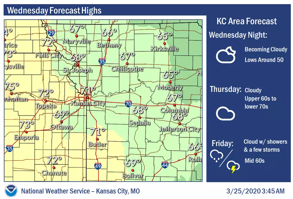
Clouds will be slow to dissipate today and that will affect how much we warm up. But we should be able to climb into the upper 60s to near 70 degrees by this afternoon.
Isolated thunderstorms may occur within the greater area of rainfall expected Monday afternoon, primarily along and south of I-70. No sever weather is expected.