Say Goodbye to March…April Arrives Mid-Week
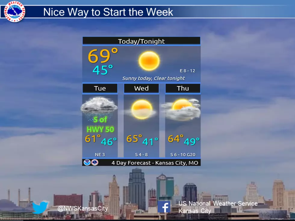
A nice way to start the week with sunny skies and 60-70s across the area. Light rain will move through the region tonight, mainly impacting areas south of HWY 50 Tuesday morning before clearing out quickly. The rest of the week looks to be favorable with the next chance of rain pushing into the region Friday.
Here's the forecast for the Sedalia/Whiteman AFB/Warrensburg area according to the National Weather Service:
TodayIncreasing clouds, with a high near 68. Calm wind becoming east 5 to 9 mph in the morning.TonightA chance of showers, mainly after 10pm. Mostly cloudy, with a low around 47. East northeast wind 5 to 7 mph. Chance of precipitation is 40%.TuesdayCloudy through mid morning, then gradual clearing, with a high near 61. North wind 5 to 9 mph.Tuesday NightMostly clear, with a low around 38. Light and variable wind.WednesdaySunny, with a high near 66. South southeast wind 6 to 11 mph.Wednesday NightMostly cloudy, with a low around 48.ThursdayA chance of showers before 1pm, then a chance of rain after 1pm. Mostly cloudy, with a high near 64. Chance of precipitation is 30%.Thursday NightA chance of rain, with thunderstorms also possible after 1am. Mostly cloudy, with a low around 46. Chance of precipitation is 40%.FridayA chance of rain and thunderstorms. Mostly cloudy, with a high near 59. Chance of precipitation is 50%.Friday NightA chance of rain and thunderstorms. Mostly cloudy, with a low around 38. Chance of precipitation is 50%.SaturdayA chance of rain. Mostly sunny, with a high near 58. Chance of precipitation is 30%.Saturday NightPartly cloudy, with a low around 41.SundayA chance of rain. Partly sunny, with a high near 64. Chance of precipitation is 30%.

More From AM 1050 KSIS