Storms Back In The Forecast
Summer is trying to hang on for a few more days. Warmer temps, humidity, and/or the possibility of storms are still in the forecast through the middle of next week.
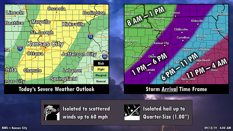
A line of storms is expected to move through the region later today, with some parts of the line potentially becoming strong to severe. The main concern is going to be strong winds, but some isolated hail and heavy rain is possible as well. Storms should move out tonight for eastern KS and western MO and then early tomorrow morning for central MO.
Here's the latest update according to the National Weather Service:
Scattered storms are possible in northwest MO/northeast KS Thursday morning, with a line of storms expected to develop and move through the entire area during the afternoon into the overnight hours.
• Some of the PM storms could become strong to severe. Strong winds are the main concern, but hail and heavy rain are also possible.
• Friday through the weekend looks dry for the time being.
 Source: Storms Back In The Forecast
More From AM 1050 KSIS