
Snow Predicted For Area Tonight
The National Weather Service is predicting a few snow showers are possible between 6 pm and midnight tonight (Feb. 25). The temperatures are expected to drop from the 40s into the 20s within a period of two hours in some parts of the state.
Any rain that does fall or any snow that initially melts upon falling, may quickly turn to ice once temperatures fall below freezing. This could cause some roadways to become hazardous later this evening, especially if left untreated.
The Sedalia/Pettis County EMA Director David Clippert issued this statement for tonight.
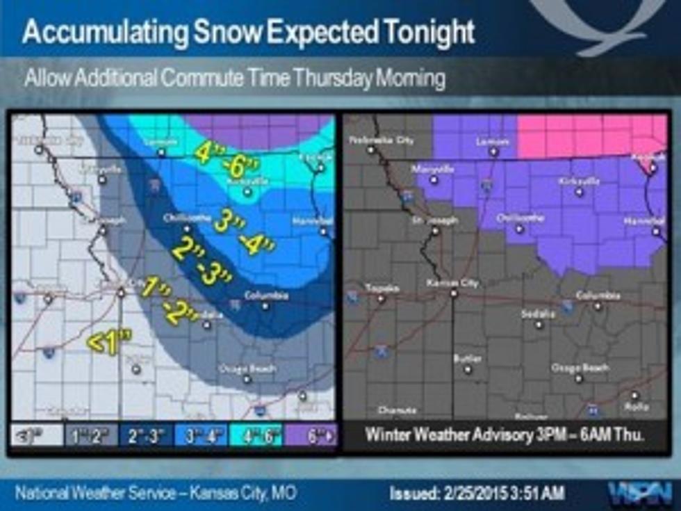
Flash freezing is a possibility tonight. I wasn't expecting any ice with any of the snow we are expecting. Temperatures will start to fall rapidly around 10 to 11 PM. If it is raining we could see this instantly freeze causing very slick conditions. Sometime overnight this rain should turn to snow. Still expecting 1 maybe 2 inches of snow. The Flash Freeze is dependent on IF we get rain first. Right now it looks like mostly snow is near Pettis County.
We are watching a system moving in Saturday that could drop 3-5 inches of snow. That is still a little ways out so that forecast may very well change
More From AM 1050 KSIS