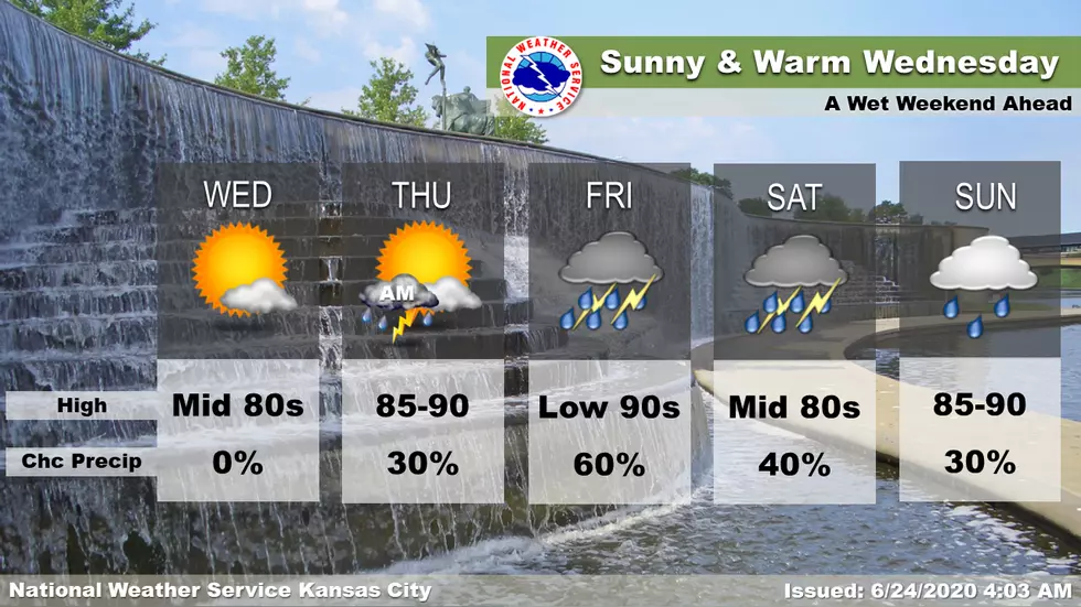
The Heat Slowly Rises as We Get to the End of the Week
A sunny Wednesday leads to a warm Thursday with the potential for thunderstorms during the morning. Friday starts out hot and steamy, but strong thunderstorms roll in during the afternoon and evening. Showers and storms continue through the weekend.
Here's the forecast for the Sedalia/Whiteman AFB/Warrensburg area according to the National Weather Service:
TodaySunny, with a high near 83. Northwest wind 3 to 5 mph.TonightA chance of showers and thunderstorms after 1am. Mostly clear, with a low around 64. Light and variable wind. Chance of precipitation is 30%. New rainfall amounts of less than a tenth of an inch, except higher amounts possible in thunderstorms.ThursdayMostly sunny, with a high near 88. Light south wind increasing to 5 to 10 mph in the morning.Thursday NightMostly clear, with a low around 70. South wind around 7 mph.FridayA chance of showers and thunderstorms, mainly after 1pm. Mostly sunny, with a high near 89. South southwest wind 7 to 13 mph. Chance of precipitation is 30%.Friday NightShowers and thunderstorms likely. Partly cloudy, with a low around 70. Chance of precipitation is 60%. New rainfall amounts between a tenth and quarter of an inch, except higher amounts possible in thunderstorms.SaturdayA chance of showers and thunderstorms. Partly sunny, with a high near 84. Chance of precipitation is 50%.Saturday NightA chance of showers and thunderstorms. Mostly cloudy, with a low around 71. Chance of precipitation is 30%.SundayA chance of showers and thunderstorms. Partly sunny, with a high near 87. Chance of precipitation is 40%.Sunday NightPartly cloudy, with a low around 72.MondayA chance of showers and thunderstorms. Partly sunny, with a high near 87. Chance of precipitation is 40%.Monday NightMostly cloudy, with a low around 71.TuesdayA chance of showers and thunderstorms. Mostly sunny, with a high near 88. Chance of precipitation is 30%.

More From AM 1050 KSIS